2,500-hectare degraded forest landscape
PROJECT
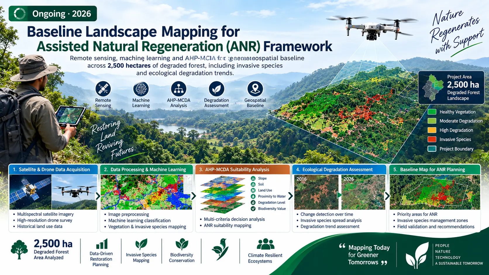
Baseline Landscape Mapping for Assisted Natural Regeneration (ANR) Framework
Remote sensing, machine learning and AHP-MCDA for a geospatial baseline across 2,500 hectares of degraded forest, including invasive species and ecological degradation trends.
PROJECT OVERVIEW
Context, evidence and action.
Remote sensing, machine learning and AHP-MCDA for a geospatial baseline across 2,500 hectares of degraded forest, including invasive species and ecological degradation trends.
ClientLIVE Foundation
LocationWest Singhbhum, Jharkhand
StatusOngoing · 2026
METHODOLOGY & COMPONENTS
Selected technical components.
Remote sensing based baseline mapping
Machine learning analysis
AHP-MCDA prioritization
Invasive species mapping
Ecological degradation trend assessment
STUDY AREA
Spatial context.
Map, imagery and field photographs can be added here to document the project area and evidence.
MAP PLACEHOLDERAdd project study-area map
LET'S WORK TOGETHER